Wednesday, July 15, 2015

Vallée du Joux

The Vallée du Joux is a valley in the Jura Mountains, cradled by limestone peaks and home to three lakes. In the local dialect 'joux' means rock. The valley is famous for its cross-country skiing in winter, numerous hiking trails in summer and lake activities all year round (swimming, sailing, ice skating and ice sailing).

We visited the charming village of Le Pont which is one the shores of Lac de Joux. There is a beautiful promenade circling the lake and we started our walk along the so-called "Promenade romantique et belle époque".


Our walk soon took us up into the mountains where there are myriad trails through forests and rocky fields, past cows and pigs and farms and barns. It was a beautiful walk up from the lake and we even saw some Toblerone blocks!

Lots of options

Halfway view over Lac de Joux

We recognise these!

Our walked finished at the peak of Dent de Vaulion where there are 360° views over the valley. There are skiing slopes at the top as well as an information point and a refuge with a restaurant.

The peak at Dent de Vaulion

Lac de Joux in one direction

Vallorbe in another direction

A route of our walk

The Vallée du Joux is the birthplace of Swiss horology and the small mountain towns boast the top ultra luxury brands of Swiss watches. On our way home we drove through the valley, enjoying the incongruous blend of small mountain villages sheltering modern horological facilities.


Sunday, July 12, 2015

Toblerone Trail

Daniel and I are enjoying a summer of exploring. We are checking out the local sites and trails in our canton, and yesterday we completed the Toblerone Trail (spoiler: no chocolate involved!). We caught a small mountain train up to the village of Bassins in the foothills of the Jura for the start of the trail and ended up in Prangins on the shores of the lake.

Our route from Daniel's Garmin

The Little Red Mountain Train

The Toblerone Trail follows a 10km long defensive line made up of triangular concrete blocks which were built in WWII from the Jura mountains down to Lake Geneva. These blocks are similar in shape to the chocolate bar Toblerone, hence the name, but were constructed for a more serious purpose: to prevent tank invasions. There are 2,700 blocks along the line and each block weighs in at between 9-16 tonnes.

These lines of defensive blocks can be found all over Switzerland, but are predominantly located in border areas. Due to their location from the Jura to the Lake, Switzerland was essentially saying that Geneva, surrounded on three sides by occupied France, was expendable... The blocks used to extend 50m into the lake to prevent an amphibious assault on Switzerland.

The line has been left to nature since its construction and it was decided to keep the blocks intact and make a hiking trail along their route, the Sentier des Toblerones. They are now covered in moss and ivy and look part of the natural forest.

The trail goes through the blocks


The trail itself is beautiful as the blocks follow the natural barrier of the Promenthouse-Sérine valley along the course of three rivers. We found a perfect spot for a picnic lunch a few kilometers into our 20km walk and enjoyed the rivers, mountain views and forest trails.

A lovely historical spot for lunch

Crossing the Promenthouse River

Toblerone blocks in the foreground and Mont Blanc in the background

Passing under a picturesque bridge

Lots of blocks in the forest!

A fortified post along the line

Follow the yellow signs!

We saw a little mouse on the trail :)

The line was built along twelve fortresses, two of which have been restored to their original appearance. One is the Villa Rose which was built in 1940. It has false windows and 2.5m thick walls. The ground floor consisted of several gun emplacements and the basement was used as the sleeping and eating quarters for the troops stationed there. We are waiting for an appointment to visit inside the villa.

An old fort on the Domaine Imperiale golf course


Sunday, July 5, 2015

Zurich Parcoursvita

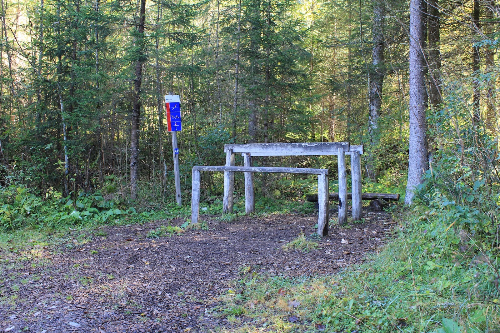
The Zurich Insurance Company started an initiative called Parcoursvita in 1968 to encourage outdoor recreational sports and promote a healthy lifestyle, quality family time and contact with nature. Today there are 500 trails all over Switzerland, sponsored by Zurich and maintained by the local communes. These trails 'borrow' 2-3km of forest trails with an easy, medium or difficult rating, and each course has 15 stations for stretching and strength work.

Map of Switzerland with the Parcoursvita routes marked
Blue = easy; red = medium; black = difficult

AUBONNE
We first learnt about these trails at the welcome dinner for new residents in Aubonne as our village maintains a Parcoursvita near the Arboretum. The course is 2.1km and has a medium ranking, and the whole trail is in the shade of the forest, next to the Aubonne River.


MONTRICHER
We love this trail so much we decided to explore some of the other routes in our area. We went back to Montricher (which is an access point for Mont Tendre) to test out the 2.6km course there. It is a difficult course and there is a lot more climbing and less shade than Aubonne.


APPLES
We also checked out the Parcoursvita in Apples, which is more similar to Aubonne -  2.2km and medium. It was a very nice shady course and we'll definitely go back to keep fit.


RAVOIRE
I checked out the Parcoursivita at Ravoire while Daniel did a training session in the Alps. This one was 2.4km and had a black rating - lots of climbs! Unfortunately it wasn't very well sign-posted and I got pretty lost. This meant I had more climbing to do than anticipated, but I got to enjoy some pretty great views while I was out.

The route coincided with parts of a trail called 'Les fours à pains de Ravoire' which goes past the 13 communal bread ovens which were built in the 1850s to serve the 20 hamlets in the area and were still used into the 1950s. According to the website, "Ravoire has the largest concentration of bread ovens in Valais, and possibly in Switzerland. An association for safeguarding this heritage is being formed." How's that for a claim to fame?


LES DIABLERETS
While Daniel completed a 55km race in the mountains around Les Diablerets, I completed the 2.5km parcoursvita. This is the best one I've seen so far - lots of green mossy rocks and trees along the wood chip trail, magic toadstools popping up here and there, and the beautiful Grande Eau river on the side. This one is a moderate difficulty route.


Friday, July 3, 2015

Santa Margherita Ligure

Santa Margherita is a charming seaside commune in the province of Genoa. It boasts a working port, a 16th-century castle and lots of European-style beaches (more deckchairs than sand). We enjoyed some quality pool time and some lovely dips in the warm Mediterranean Sea. We also had some delicious dinners on the waterfront with fresh seafood and good Italian prosecco. What a lovely way to end our Italian road trip!

The port in the late afternoon light

Recreational boats in the port

The rooftop pool deck

Our view from a restaurant