Showing posts with label Alps. Show all posts

Monday, August 8, 2016

Rochers de Naye

The Rochers de Naye is a mountain in the Swiss Alps overlooking Lake Geneva near Montreux. It lies on the watershed separating the Rhone and the Rhine. The summit is accessible via a charming cog railway, the highest railway in the canton of Vaud, but we took the other option: on foot!

The route 

We followed the Via Alpina trail (#1 on the Swiss trail system) up from Montreux, and the round trip covered 29km and 1580m of climbing. The first part of the route, just coming out of Montreux, passes through the Gorges du Chauderon.

The Chauderon Gorge
As the route continued up the mountain, we were treated to beautiful Alpine flowers and spectacular views over the lake. There are several activities at the top of the trail, including a marmot sanctuary, a restaurant, accommodation in Mongolian yurts, further walks along the ridge line, and ski slopes in winter.

A Chemin de Montagne

View over Lake Geneva

A good day to launch a paraglider

The steep ascent near the top

The railway station and marmot sanctuary at the top

Furry marmots!

It was a tough day out, but it's always a pleasure to see a new part of the Alps!

Gorges du Durnand

Champex-Lac is the midway point on the CCC route and we spent a couple of nights nearby while Daniel did some training. It is accessed by an incredibly steep and winding road and we discovered that just off the road is a hidden valley with the Gorges du Durnand. The gorge was made accessible in 1877 and is ranked in the top ten most beautiful gorges in Europe!

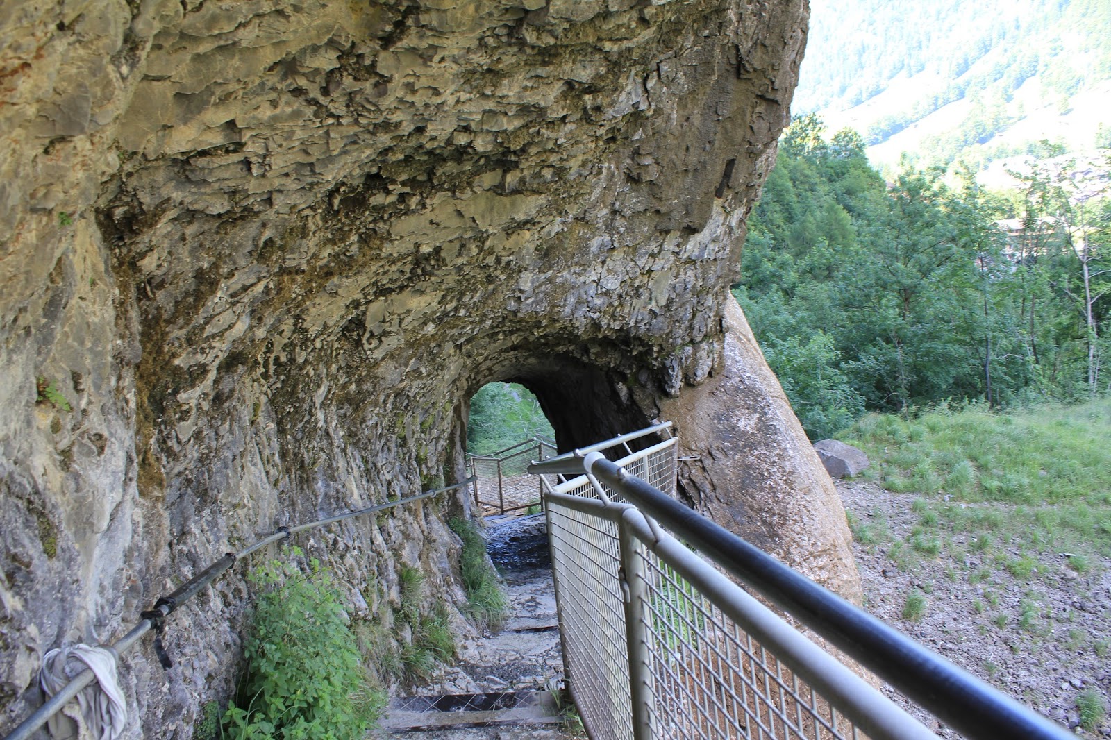
We have visited a few gorges recently (Aare, DiosazChauderon), but this one was something special. It is accessed by wooden walkways and stairs (330 steps in total) which hang steeply over the raging torrent below. The climb up the 'floating stairs' is an adrenalin-inducing ascent, and even though we completely trust Swiss engineering, we felt the magnetic pull of the water down below! There are 14 cascades along the route accessible to the public, and visitors who make it to the top will be hard pressed to say whether it was the falls or the climb that took their breath away!

Waterfalls and wooden walkways
A very steep climb!
See some of the 330 steps up the side of the gorge

Beautiful cascades plunging into pools

Parc de Merlet

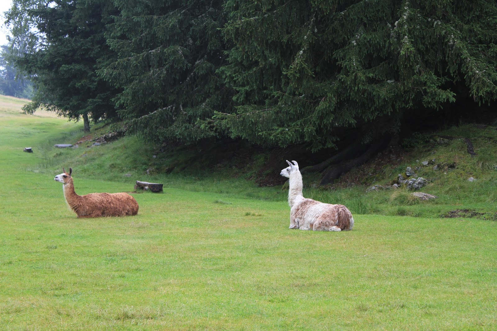
While Daniel was out conquering mountain trails, I visited the Parc de Merlet, a wildlife sanctuary in Les Houches just outside of Chamonix. It is home to many Alpine animals, including marmots, chamois, ibex and deer, and also has a few imported animals such as Japanese sika deer and even a couple of llamas! The animals receive food twice a day throughout the year, but are otherwise free to come and go as they please, making them 'semi-wild'. There are large quarantine enclosures for some animals, but the rest wander at will through the spruce trees and meadows. There are a few trails through the park and visitors can get quite close to the animals.

The feeding area


A small chapel on the grounds

A couple of llamas in the meadow

A sika doe
The climb up from the parking lot to the park entrance is pretty steep, but it's worth it. It's great to see the animals up close and there are also spectacular views over the Mont Blanc massif.

It was a bit cloudy on my trip, but I glimpsed
Mont Blanc, a glacier and a waterfall through the clouds!


Thursday, August 4, 2016

Courmayeur - Champex-Lac - Chamonix

At the end of August each year there is a mountain trail festival based in Chamonix in France. This year Daniel is competing in the 'CCC', a 101km race from Courmayeur (Italy) through Champex-Lac (Switzerland) to Chamonix (France). We spent part of our summer doing a recce of the route. Daniel learnt the trails and I renewed my impression of how hard his job is (those mountains are high!!).

Chamonix and Mont Blanc - where the trail ends

The race starts in Courmayeur, an Alpine town in Italy which is accessed through the Mont Blanc tunnel. We hiked up to Grande Col Ferret at 2537m which forms the international boundary between Italy and Switzerland. How cool to hike to another country!

The Aosta Valley in Italy where the race starts in Courmayeur

The international border in the Alps (from the Swiss side)

The route down into Switzerland is beautiful. The Alps were at their most majestic as we descended the fairly steep path. Fortunately there was a convenient and much-appreciated refuge en route where we stopped for a rest and lunch.

La Peule Refuge - great sandwiches here!

Green mountains and cascades

Lots of hiking options. We followed the TMB route.

Glacial rivers abound in this region

The halfway point of the race is at Champex-Lac in Switzerland. We've visited here before on a day trip, and it was good to return to an old haunt. We spent two nights in nearby Bourg-St-Pierre, including the Swiss National Day on 1 August, but the clouds rolled and the wind picked up at night so we didn't see any fireworks.

Champex-Lac

The race route continues to wend its way up and down the Alps, reaching a total of 6,100m of vertical gain. I joined Daniel for a hike between Vallorcine and Chamonix, the last 18km of the race. At the top of the pass at Tête au Vents we saw three chamois, including a baby! It was a sturdy little creature, true to its goat-antelope heritage. The views from the top were spectacular - a panorama of mountains, glaciers, waterfalls, and of course, the highest mountain in Europe, Mont Blanc.

A chamois mother and kid

Glaciers overlooking the Chamonix Valley

The peak at Tête au Vents with Mont Blanc in the background

The race reaches its grand finale in Chamonix, where we've spent time before. This season, we've visited the Alpine resort a few times for Daniel's training. During some of his runs, I did a bit of sight-seeing around the region, including visits to Parc de Merlet, Gorges de la Diosaz and Gorges du Durnand.

Mont Blanc overlooking Chamonix
A rainbow in the clouds above Chamonix!

Annecy, France

A lovely day trip from Aubonne is to Annecy in France, 35km south of Geneva. This charming city has been nicknamed the "Pearl of the French Alps" and the "Venice of the Alps". It lies between the mountains and a lake and has two canals and a river running through the old town. It has also won the "Golden Flower" award for being one of the nine most-flowered cities in France!

Needless to say, it is idyllic. We spent a beautiful summer's day having a picnic in the park by the lake and strolling through the old town.

Restaurants lining a canal in Annecy Le Vieux (the old town)


One of the canals passing through Annecy

The Palais de l'Isle in the Thiou River

Promenade along the lake


Lake Annecy and the Auvergne-Rhône-Alps

The park on the lake's edge


Sunday, July 10, 2016

Reichenbach Falls

We based ourselves just outside of the town of Meiringen for the day, where our first adventure was to catch the funicular up to the famous Reichenbach Falls, a series of waterfalls in the Bernese Oberland region.


The Reichenbach Falls are famous in popular culture as the location of the final altercation between Sherlock Holmes and Professor Moriarty in Sir Conan Doyle's "The Final Problem". Holmes and Moriarty both plunge to their deaths down the 250m drop of the falls. However, it later emerges that Homes survived. We walked round the falls to the ledge where the fight took place, but unlike the many pilgrims who dress up as the characters and visit these falls, we did not conduct a reenactment of the final scene!


On a more practical note, the falls are one of the highest cataracts in the Alps and provide water for a hydro-electric plant, one of 40 along the river. The falls feed into the Aar river which is the longest river that both rises and ends entirely in Switzerland. The views from the top over the Reichenbachtal valley were spectacular!

The town of Meiringen


We were delighted to see some Toblerone blocks on our descent!

Bernese Oberland

Summer is finally here bringing seven weeks of holidays for me and peak race season for Daniel! We combined our respective schedules for a trip to the Bernese Oberland for a week of camping, exploring and training.

Home for the week

Our first stop was in Grindelwald where we set up camp for the week. This is a quaint Alpine town surrounded by peaks, glaciers and breath-taking views. It is favoured by tourists in winter and summer and is the gateway to the Jungfrau, Eiger and Mönch, a mountainous wall overlooking the Bernese Oberland and the Swiss Plateau, and one of the most distinctive sites of the Swiss Alps.


We spent an afternoon in Lauterbrunnen, "the place of clear springs". The valley is one of the deepest in the Apline chain and is famous for the numerous waterfalls gushing down its steep sides. We visited the most famous of these, the Staubbach Falls. The height of the cascade is 250m, one of the highest in Europe formed of a single unbroken fall. The water becomes spray before it reaches the level of the valley. We climbed up a rocky mountain path and walked on a ledge behind the waterfall!

Lauterbrunnen Valley and the Staubbach Falls


Free hiking poles to borrow for the climb up behind the falls!

Exciting tunnels and stairs chiselled into the side of the mountain

Beautiful views from the top through the mist of the waterfall

While Daniel was out running in the mountains, I took a trip to Interlaken, an important and well-known tourist destination in the region. The town is located in between Lake Thun and Lake Brienz and alongside the Aare river which flows between the two lakes. The town has a system of canals to navigate to other lakeside towns and is the starting point of a sequence of connecting mountain railways to get visitors up into the high peaks of the Alps. I strolled along the canals and had lunch while watching the paragliders land in the big park overlooked by the Eiger.

The Eiger peak peeking through!